Categories
Data Publications

New Bean Atlas of Africa released

The Atlas of Common Bean (Phaseolus vulgaris L.) Production in Africa, has been updated with new information and addresses additional topics such as bean seed systems, and the consumption and use of beans. Go to the storymap for access to the spatial data and the book pdf.

The new Atlas is digital and available as a dynamic, interactive online version with selected maps.

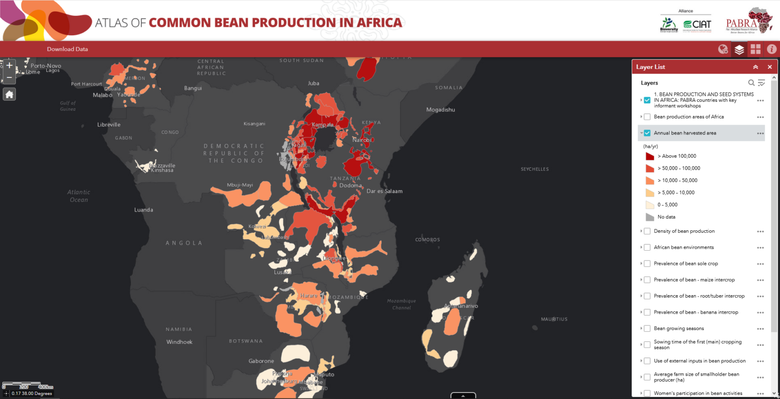
We identified a total of 176 bean production areas. We used a form of the Delphi method of consensus building among experts from almost all bean-producing countries of sub-Saharan Africa. We collected data for: bean production, cropping systems and producers; seed systems; bean use and marketing; bean grain types and varieties; and abiotic and biotic constraints to bean production and storage.

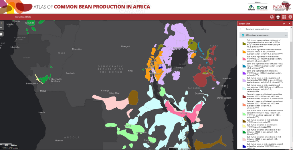
We compiled data on harvested area and production from a variety of sources and allocated among bean production areas using local expert knowledge and/or sub-national statistics. We computed and characterised each bean production area within 17 different bean environments.

African Bean Environments displayed in the online version of the Atlas of Common Bean Production in Africa
Categories
Publications

GeAgrofía co-author of paper “A spatial framework for ex-ante impact assessment of agricultural technologies”

In this study, we developed a data-rich spatial framework to guide agricultural research and development prioritisation and to perform ex-ante impact assessment. The framework uses “technology extrapolation domains”, which delineate regions with similar climate and soil type combined with other biophysical and socio-economic factors that influence technology adoption.

Paper available here.

A generic framework for ex-ante impact assessment in rainfed crop agriculture
Categories
Publications

Stakeholder roles in Sub-Saharan African agricultural netchains paper published

Paper available here.

Categories
Publications

Mapping Agricultural Suitability report available from UNEP-WCMC

This report provides an overview of existing approaches to mapping agricultural suitability, including review of the underlying data, at different scales. Mapping land use suitability can help identify the best places for different future land uses and support a more efficient and effective use of resources and energy to satisfy changing patterns of human consumption, to slow global warming and to reduce the rate of loss of ecosystem services and biodiversity.

Get the report here.