Geagrofía can help you to analyse access to markets and inputs in ArcGIS, QGIS or R.
Click on the links to view the maps or reports of previous accessibility and spatial interaction studies, where available.
Developing rural agricultural input markets can improve the current low productivity since inputs are still difficult to obtain for many remote smallholder farmers.
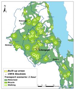
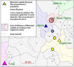
Spatial analysis can help in the expansion of input stockists, especially agro-dealer networks, by assessing the coverage of existing input outlets and deriving optimum locations for village-level input stockists. Here is a zip file ( Greedy add aml heuristic ) which contains the optimisation aml used in the Malawi optimisation study, some test data, and a quick guide on how to use it. Reilly’s Law states that flows of goods, services, and information between two places depend on the populations of those two places and the ease of travel from one to the other.
Some of our past research has tested this ‘law’ in the context of spatial interaction models for output markets for milk in Colombia.
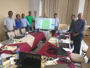
Training GIS professionals in accessibility analysis
GeAgrofía now trains GIS professionals in developing countries to use and customise tools for analysing accessibility in QGIS and R.